- Chalk up, rope in, and climb on, in one of the most acclaimed climbing areas of the west.
- With over 1,600 miles of hiking, biking, and horseback riding trails available you will never have a 'deja vu' moment in the Bitterroot.
- Feeling strong, hike Trapper Peak, a mere 10,157 ft.
Overview
Straddling the border of Idaho and Montana, the 1.6 million acre Bitterroot National Forest, is an adventurer's paradise. Glacial formation left this forest with deep canyons, staggering peaks, alpine lakes, and clear mountain streams.
Composed of two mountain ranges, the Bitterroot and Sapphire, elevation ranges from 3,200 ft to Trapper Peak which looms over the forest at 10,157 ft. With over half of the land protected in three different wilderness areas, the Bitterroot is home to the largest continuous stretch of forest in the lower 48 states. You don't have to go far to feel like you are in the heart to the forest.
As you climb in elevation, you'll pass through valleys of douglas fir and larch that give way to whitebark pine. At 8,000 ft the trees will disappear, giving way to fields dressed in alpine flowers and grasses. The terrain is pristine and varied and home to animals big and small.
Location & Information
Just a 45 mile drive south from Missoula down Hwy 93, the Bitterroot National Forest is the city dwellers playground. With easy access and a multitude of canyons just waiting to be explored, the Bitterroot provides a different adventure every time. Brown forest service access signs are usually visible from the highway.
The forest service headquarters for the Bitterroot National Forest is found in Hamilton, MT. Other field offices are found in Stevensville, Darby, Sula, and West Fork. Stop by any of these offices to purchase maps or ask questions.
Bitterroot National Forest Headquarters
1801 N. First Street
Hamilton, Montana 59840
(406) 363-7100
r1_bitterroot_comments@fs.fed.us
Activities
1,600 miles of trails, 18 campgrounds, and a mult-use philosophy means the Bitterroot National Forest literally has something for everyone. Below are some ideas to get you started.
Hiking
Pick any canyon and your bound to find a hike. Stick to the valleys for an easier adventure or test your stamina with an upward adventure up one of the mountains. The views will amaze from every angle. Be aware of your surroundings. There is a bounty of wildlife present in the canyon, including the grizzly bear, which was reintroduced in 2003. Just like us, they don't like to be startled, especially when their cubs are present.
- Blodgett Canyon Overlook Trail #101: This easy and picturesque 2 mile hike will take you past the burn of 2000, where small saplings are starting to rejuvenate the forest. Bring your camera because the view from the overlook, a scenic rock cliff, is breathtaking. From Hamilton, take County Rd # 68 to Forest Road #736, this will lead you to the trailhead. The hike actually starts at the Canyon Creek trail, #525, before splitting off toward the north about 100 ft in.
- Camas Lake Trail #125: In early summer, this is the hike to take to see wildflowers in full bloom. This 4 mile, moderately difficult hike starts on an old logging road, opens up for views of Bitterroot Valley, and then takes you to the promised Camas Lake. 8 miles south of Hamilton on Hwy 93, turn west onto Lost Horse Road. Continue to FR #496 for 4 miles. This will lead you to the trailhead.
- Overwhich Falls Trail #182, 248, & 673: Looking for something a bit longer? This 8 mile, moderate hike is worth the effort. Steep and rocky sections will keep you on your toes as you make your way to the falls. Don't be discouraged by the many turns it takes to reach the trailhead. Take US Hwy 93 to MT road 473. Go past Painted Rocks Lake to FR #5703. At FR #5703, turn right and continue until you reach the junction of FR #5706. It's another 7 miles to the trailhead. Start on trail #182 for roughly 3 miles, head east on #248 for another 4 miles and then take #673 southeast to the falls.
Mountain Biking
Most hiking trails double as biking trails because of the Bitterroot National Forest multi-use policy. Obviously some will be more desirable then others. As is true with many of the trails in the forest, biking trails merge again and again with other trails, so pay attention so you don't get lost. Below is an example to get you excited.
- Heart Bench Mountain Bike Loop: Not for the faint of heart or lungs as this 16 mile road loop includes a continuous amount of uphill with a slight elevation gain. Luckily, with elevation comes picture worthy vistas of Trapper Peak and the Bitterroot River. South on Hwy 93 past Darby, turn west on West Fork Road #473 to Leavens Gulch Road. Take a right and continue on until you reach FS Boundary Road #5711. Don't park on private property, use one of the many turn outs.
Fishing
Where a river runs through it says it all. Fisherman from all around the world come to Montana to fish the east and west forks of the Bitterroot River. Between the rainbows, the cutthroat, and the brown something is bound to bite your fly no matter which hatch is taking off.
Look for fishing access signs on the side of the highway. Make sure to get a fishing license at one of the many local fly shops.
In addition to the Bitterroot River, try some of it's many tributaries like Kootenai Creek, Blodgett Creek, or Tin Cup Creek.
Water Sports
In addition to fishing, try some boating, motorized or non on Lake Como. Complete with bathrooms, picnic tables, campgrounds and even beaches, you will be entertained all day. And if you don't feel like leaving, pitch a tent or just stay the night in your RV.
Water levels do fluctuate as this is an irrigation reservoir. Levels are at their highest late spring to mid-summer, but drop off as it gets hotter and the need for irrigation grows.
Access is super easy, take Hwy 93 south to the Lake Como turn off. Plenty of signs will lead you the remaining four miles to the lake.
Rock Climbing
The glacially formed canyons of the Bitterroot National Forest provide perfectly exposed granite rock faces, ideal for rock climbing. Here are two of the big name destinations.
- Blodgett Canyon: The South Face of the Flathead Buttress, hails as the best big wall climbing in the Missoula area with 1,200 feet of sustained vertical. Multi-pitch or full ascent this canyon has a fantastic amount of options. Take Hwy 93 south from Missoula to Bowman Road, turn right. If you pass over a silver bridge you have gone too far. Continue on to Ricketts Road, take a left and travel about 2 miles. Take a 90 degree turn at the four way intersection and continue on Blodgett Camp Road to the trailhead.
- Kootnei Canyon: All grades available and routes that fit your level. There are long pitches so bring two ropes. Hwy 93 south from Missoula, turn right on Kootenai Canyon road, just north of Stevensville. Take the trail into Kootenai Canyon. The wall will show itself a short distance later.
Horseback Riding
A top the back of a horse is a great way to travel deep into the heart of the Bitterroot National Forest. Most hiking trails also double as horseback riding trails. If in doubt, check with one of the ranger stations. Trailheads will also identify which activities are prohibited.
Camping/Cabins
Sometimes a day just isn't enough time to completely enjoy such a majestic place. Luckily, there are 18 campgrounds within the national forest. They do vary in terms of amenities. Back-country camping is also available.
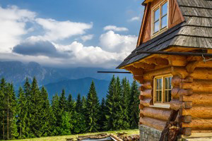
Looking for a different camping experience, check out the rustic rental cabins. Don't expect modern amenities since most of the cabins used to serve as fire lookouts and back country ranger and work stations. The rental fees are used for maintenance and management.
For information or reservations for rental cabins call 1-877-444-6777.
Hunting
With the controversial introduction of the gray wolf and pneumonia among the bighorn sheep, big game numbers have been down in the Bitterroot National Forest. Don't be discouraged as hunting season for bears, moose, elk, you name it, still continue in their requisite seasons.
Cross-country/Snowshoeing
The national forest isn't just for summertime fun. When it snows, just strap on your snow shoes and go exploring. This minimal impact activity is a great way to enjoy the snow filled valleys of the Bitterroot.
In addition, cross-country skiing trails are available at Chief Joseph Pass, located 100 miles south of Missoula off Hwy 93. Turn onto Hwy 43, where over 24 kilometers of groomed trail await your gliding skiis.
Downhill Skiing
Find the line and down the mountain you sail with the wind rushing past you. This is the feel of downhill skiing, the most classic of winter sports. Operating under a special use permit within the national forest you will find only one ski resort, Lost Trail.
- Lost Trail Powder Mountain: Atop the continental divide, this resort averages 300 inches of snowfall a year and vistas that will leave you in awe. Just an 1/8 of a mile off Hwy 93 and Hwy 43 junction. Open Thursday to Sunday starting in December.
Snowmobiling
Vroom, vroom your way through the snowy valleys. Interest for snowmobiling continues to grow, as more folks discover the enjoyment of fast speed winter wonderland tours. Except for in the wilderness areas, snowmobiling is allowed on most trails.